An exhibition of work by art, design, media and architecture students from Manchester Metropolitan University
Martin Kevill
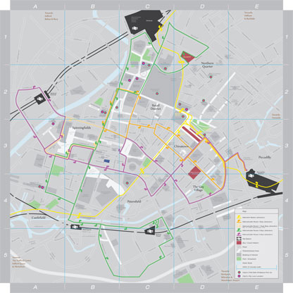
Scattered around the city centre on touch screen information points, 'Route Around Manchester' is an interactive map of central Manchester which allows users to choose what they want to see on their piece of cartography and print their very own version of the city. This means for example, that if someone never uses the Metroshuttle, they can leave this information off, or if they need to find the closest library, they can add every library onto the map. This lets users negotiate with maps, instead of having to take them as they are, providing a more rewarding experience. The interface will also offer tourists and other users highlights of the city and interesting places within reach of the location.
'Route Around Manchester' will be accompanied by a printed street map that focuses on bringing together the main public transport systems running in the city centre. There are many maps available at the moment, but very few of them show the transport systems evenly, many of them focussing on one particular system or route. This map will allow users to use the one map, instead of having to move from map to map when moving through the city.
